Where are we?
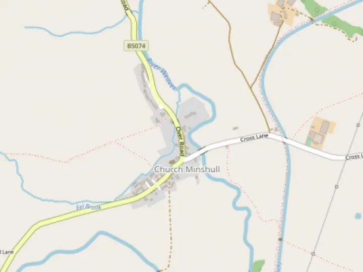
Church Minshull community is located approximately 5 miles (8.0 km) north west of Crewe and to the west of the River Weaver and the Shropshire Union Canal.
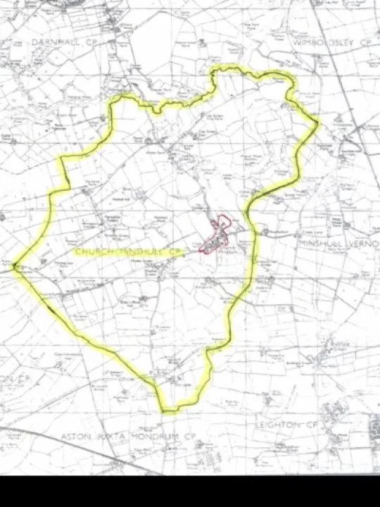
Click here to view a map of Where We Are.
The principal road through the community of Church Minshull is the B5074 between Nantwich (6 miles to the south) and Winsford (4 miles to the north).
The parish of Church Minshull is made up of 2285 acres. It extends to Boundary Wood (incorporating Home Farm Park and Lea Green Villa Farm), in the north, to Woodgreen Farm and Rosalie Farm in the west, to The Aqueduct Marina in the south and Church Minshull Village in the east.
Page last updated: 24/01/22 15:23
Quick Links
Get In Touch
VillageArena is powered by our active community.
Please send us your news and views using the button below: